
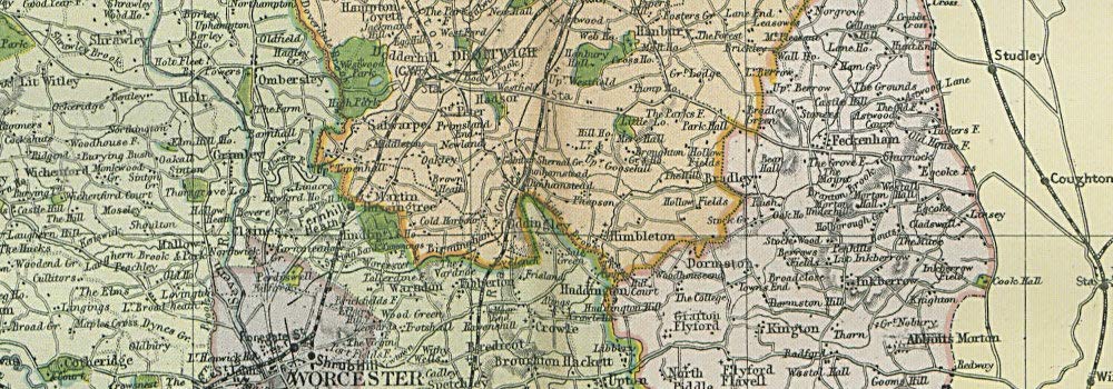
Antique Map: WORCESTERSHIRE & GLOUCESTERSHIRE NORTH. Parliamentary divisions. BACON. Title: 'Worcestershire and Gloucestershire [north sheet]'. Type: Antique colour map. Date of printing: 1900. Size: 33.0 x 48.0cm, 13 x 18.75 inches (Large); Please note that this is a folding map., 1596 sq cm. This item is folding. Artist, cartographer or engraver: GW Bacon. Condition: Good; suitable for framing. However, please note: The image shown may have been taken from a different example of this map than that which is offered for sale. The map you will receive is in good condition but there may be minor variations in the condition from that shown in the image which may include some light spotting. Please check the scan for any blemishes prior to making your purchase. Verso: There is nothing printed on the reverse side, which is plain. Provenance: "Commercial and Library Atlas of the British Isles"; Edited by G. W. Bacon; Published by G. W. Bacon & Co., Ltd., London. Subject categories: Severn Valley Bacon.
Trustpilot
2 days ago
3 weeks ago
